Go Fly (in-flight map)
The moving map you use in the air. It shows your live position on the airspace map, follows you as you go, and reads out your ground speed, GPS altitude and climb/descent rate. It can turn with your track so the way you're going is always toward the top, and it warns you — on screen and out loud — before your track would take you into an active airspace. It is deliberately a display, not an editor — there is no crosshair, no waypoint list and no Add/Finish bar, so nothing on this screen can change a flight plan while you're flying it.
How to get here: two ways — open the flyout menu and choose Go Fly, or tap the Go Fly button on a plan's detail page (the first button in the action bar, on drafts and submitted plans alike). Go Fly opens as a top-level screen, so it has no back arrow — return through the flyout menu.
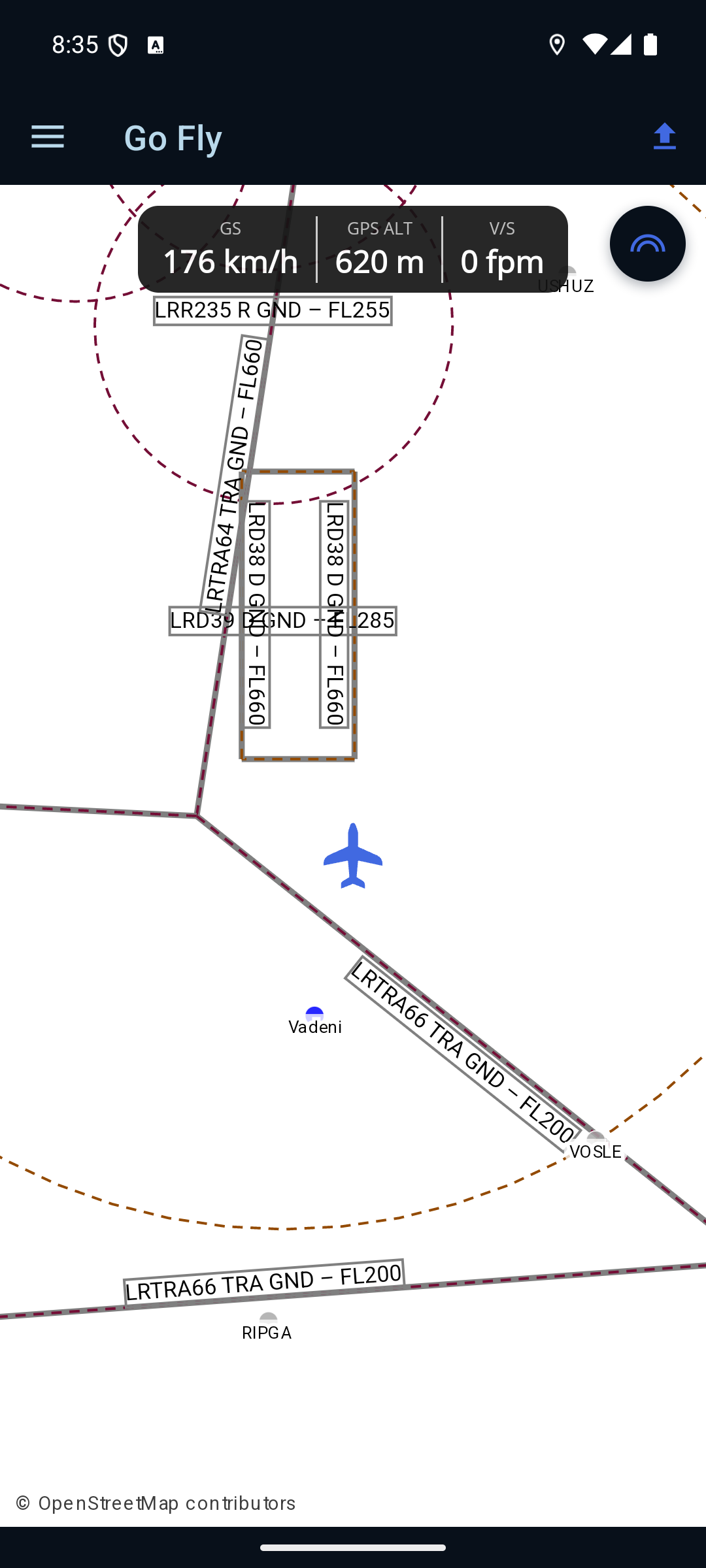
Tap the help (?) icon in the top bar to show or hide the on-screen hint.
The instrument strip
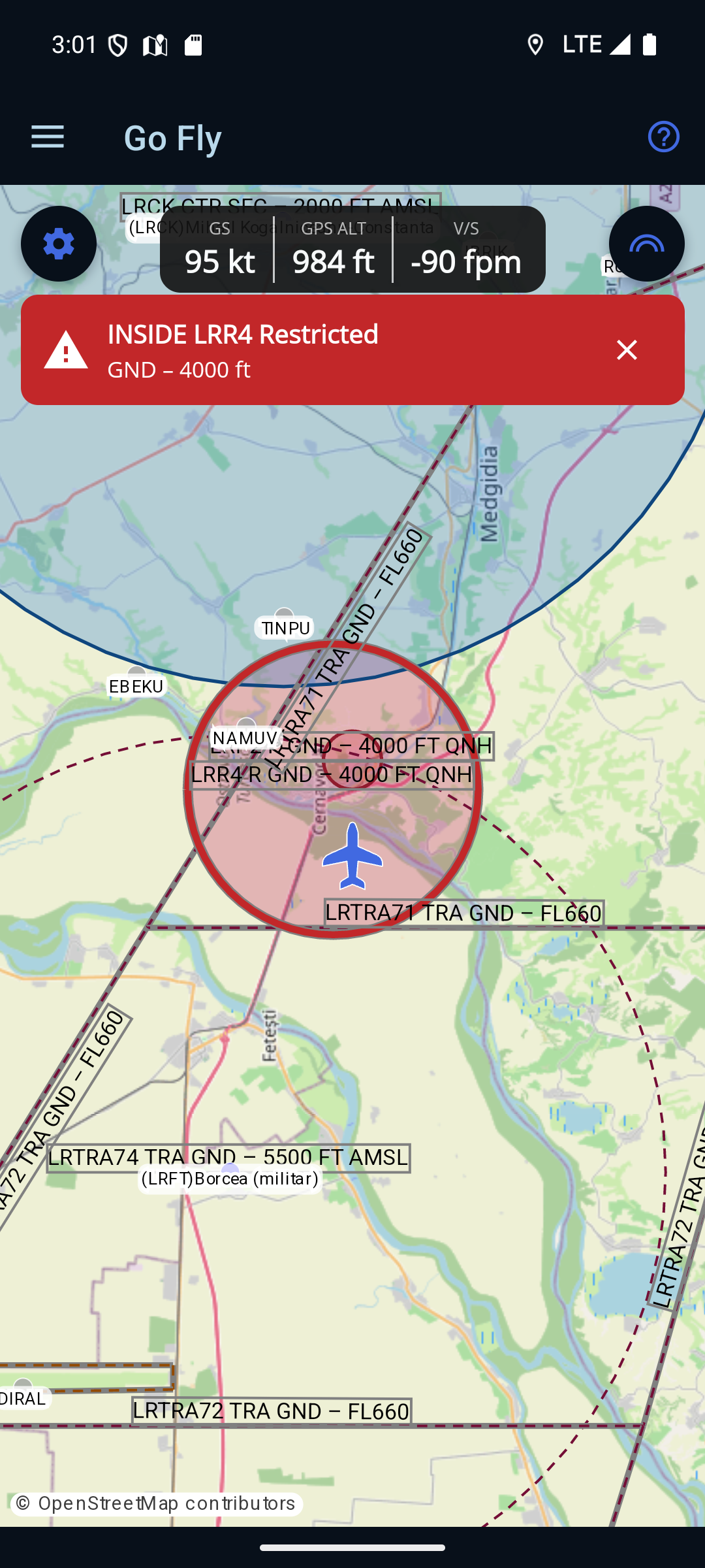
A narrow strip across the top centre of the map shows three live readings, in the units you picked under Settings → Pilot → Preferences:
- GS — ground speed, in knots or km/h. This is speed over the ground from the GPS, not airspeed.
- GPS ALT — your height from the GPS, in feet or metres. It is labelled GPS deliberately: this is a GNSS height, not a QNH/pressure altitude, and it will not agree with your altimeter. Use your altimeter for anything that matters.
- V/S — vertical speed (climb or descent rate), in feet/minute or metres/second.
Before the first fix arrives, all three read — and the strip is dimmed. A dash means no reading yet; a real 0 means the receiver is reporting zero — level flight, or stationary. The first fix can take a few seconds and may be less accurate than the ones that follow, which is normal for a receiver that has just started.
Following the aircraft
- The aircraft symbol is your live position, rotated to your track — the direction you are actually travelling over the ground, measured from north.
- The map follows you. The first fix centres the map at a sensible starting zoom; after that every fix re-centres but keeps whatever zoom you pinched to, so you can zoom in for detail and stay followed. There is no re-centre button, because the map never stops following.
- Below about 2 knots the heading is held rather than followed. A stationary receiver reports an essentially random bearing, which would spin the symbol on the ramp; instead it keeps the last direction you were actually moving in.
- The position is never guessed. The symbol only ever sits where a real fix put it — no dead reckoning between fixes.
The Settings card
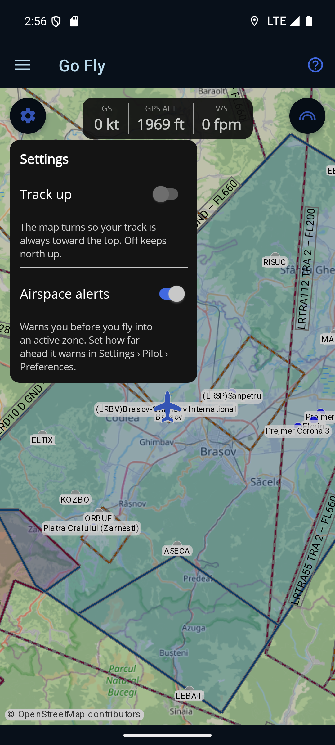
Tap the gear button in the top-left corner — the mirror of the layers button on the right — to open the Settings card. It holds the two display settings you might actually want to change in the air: Track up and Airspace alerts, both described below.
The two cards would meet in the middle of a phone screen, so opening one closes the other, and tapping the dimmed background closes either. Both settings are remembered between sessions — set them once and they are still there on your next flight.
Track up
With Track up on, the map turns so the direction you are travelling is always toward the top of the screen and the aircraft symbol sits nose-up. With it off, north stays up and the symbol rotates instead. Which you prefer is personal — track up matches what you see out of the window, north up matches the chart.
- Choosing North up straightens the map once, then leaves it alone. It does not hold the map at north on every fix. That is deliberate: you can pinch-rotate the map yourself, and a setting that re-straightened it once a second would fight you.
- Airspace labels stay readable at any rotation. Area names and their vertical limits are kept the right way up as the map turns, so they never end up upside-down. The base map's own place names come from OpenStreetMap and do rotate with it — that difference is expected, not a fault.
- The map only turns when your track really changes. A GPS course wanders a degree or two between fixes; small changes are ignored rather than nudging the map every second all through the cruise.
Airspace alerts
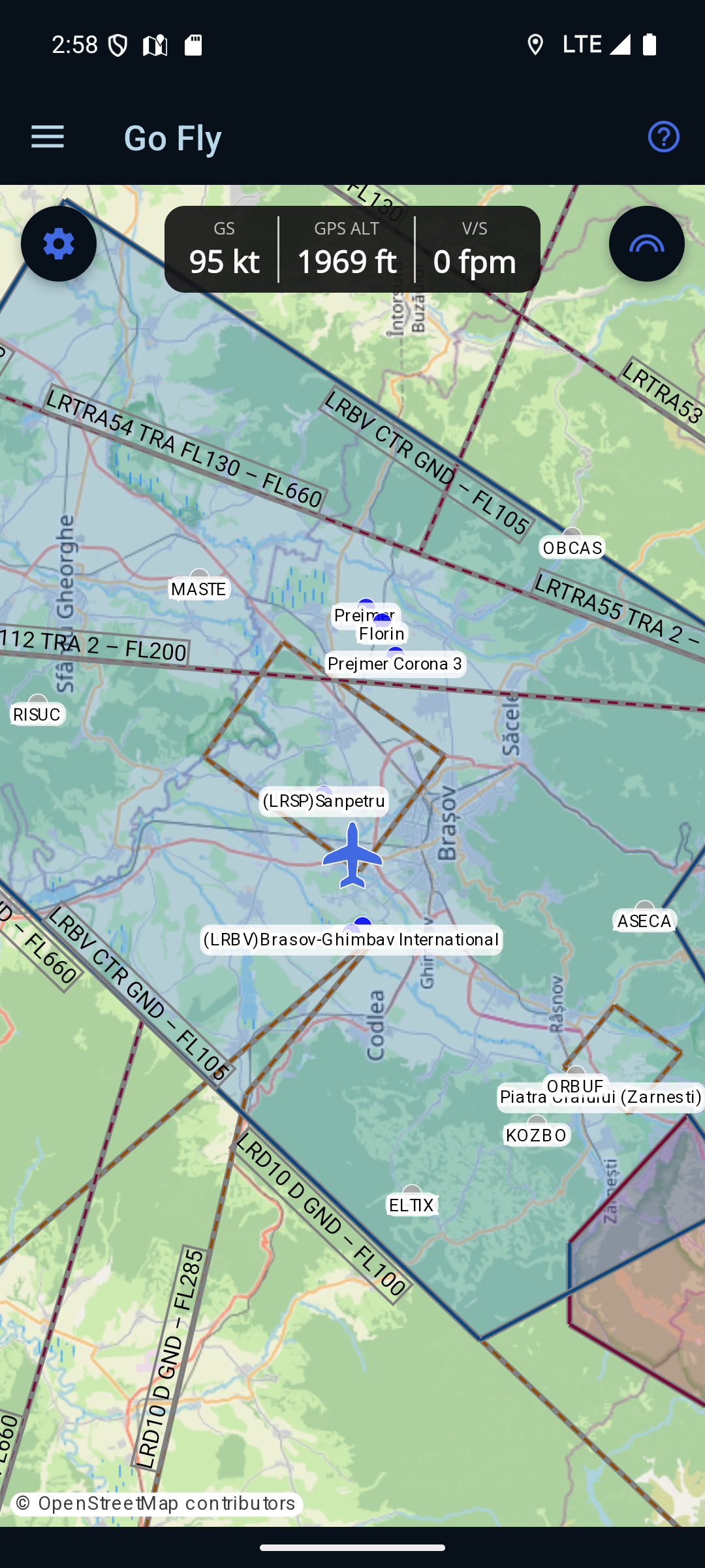
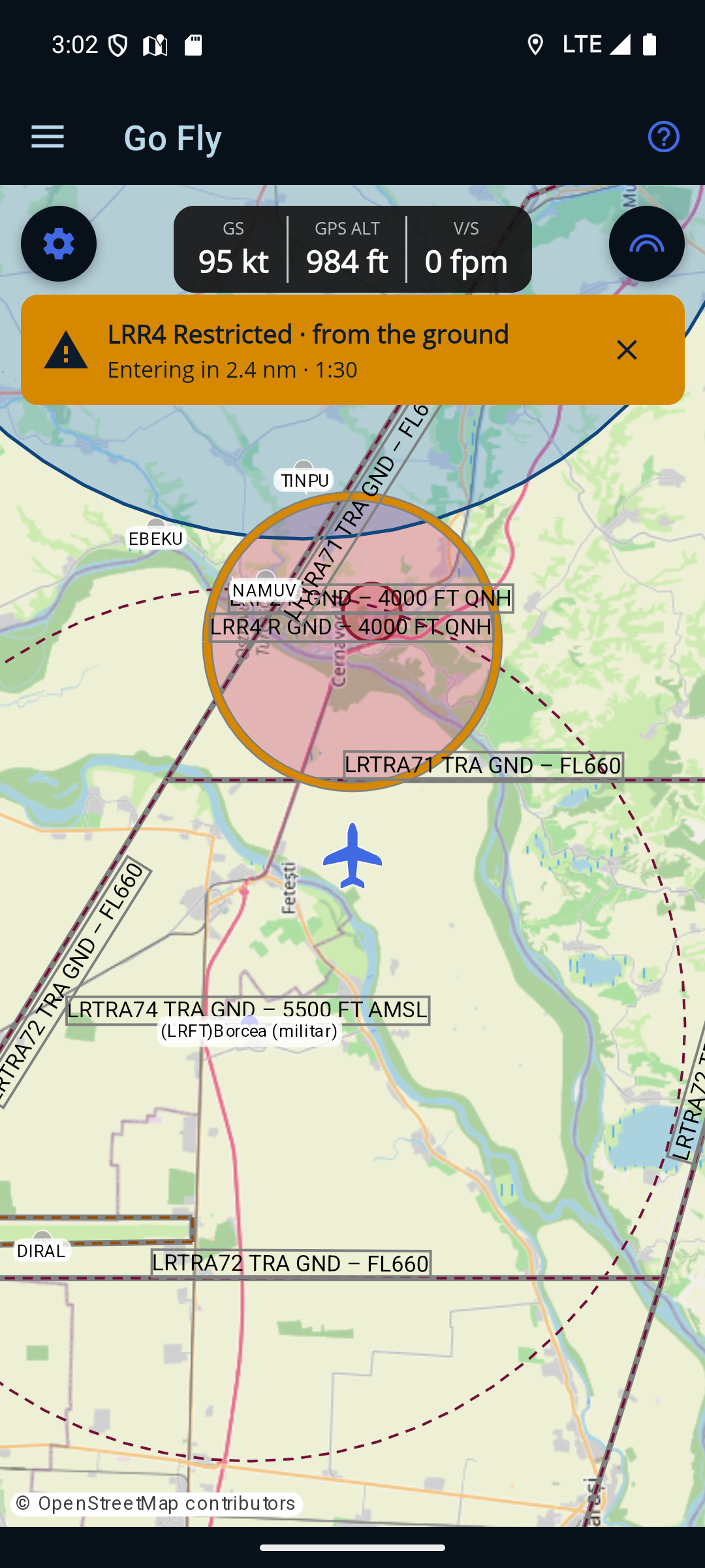
Ro Flight watches your position and altitude against the airspace around you and warns you before your track would take you into an active area — and again if you enter one. The warning is a coloured banner across the top of the map, a chime, and the area outlined on the map in the same colour, so the banner and the map always agree. Alerts are on by default; the switch is on the Settings card above.
The two levels
- Approaching — amber. Your track would take you into the area within the warning time. The banner names it and says where it begins vertically — for example LRR4 Restricted · from the ground, or · above 1,500 ft for an area that starts higher up — and the line below gives how far and how long: Entering in 2.4 nm · 1:30.
- Inside — red. You are in it. The title leads with the word — INSIDE LRR4 Restricted — and the line below gives the area's vertical extent, because what matters then is whether climbing or descending gets you out.
What it warns about, and when
- Only the categories you have switched on. The alert reads the same filter as the Airspace panel, so hiding a category there is you agreeing not to be told about it. What is on the map is what warns.
- Only airspace that is actually active — permanently active areas, and ones a NOTAM has activated. A zone that is charted but cold does not warn.
- One chime per warning, not one per second. The distance counting down is the same warning. A new chime means something changed: a different area, or the same one going from approaching to inside.
- Tap ✕ to dismiss a warning you have seen and dealt with. It suppresses that one area at that one level; anything else still warns.
- How far ahead it warns is yours to set — 1 to 4 minutes, under Settings → Pilot → Preferences. The default is 2 minutes.
- Stationary, it will not predict an approach — below roughly 10 knots your GPS course is arbitrary, so there is no meaningful direction to project. It still tells you if you are inside an area, because that needs only a position.
- The height it compares against is your GPS altitude, not your altimeter. Airspace floors are published against pressure altitude, and the two can differ by a few hundred feet. Ro Flight deliberately allows a wide margin, which means it will sometimes warn about airspace you are in fact comfortably clear of underneath. That is the trade chosen on purpose — a spurious warning is cheaper than a missed one.
- It looks ahead along your track, not up or down. If you are already underneath an area and climbing toward it, you will not be warned until your altitude comes close to its floor.
Airspace and NOTAM areas
The map draws the same charted special-use airspace and active NOTAM areas as the route map, each shaded, outlined and labelled with its name and vertical limits (for example LRD38 D GND – FL660). Your departure and destination aerodromes and the published waypoints are shown as small pins for orientation — they are drawn lighter than on the planning map, because here the subject is the aircraft and the airspace around it.
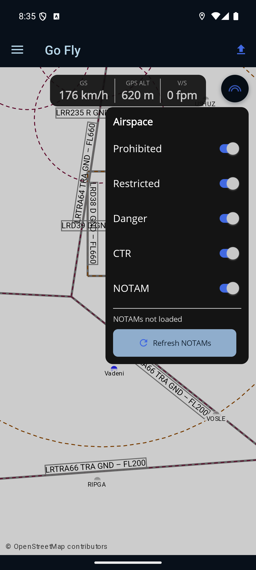
Tap the layers button (top-right) to open the Airspace panel and choose which kinds of area are drawn — Prohibited, Restricted, Danger, CTR and NOTAM. Below the switches, a line shows how fresh the NOTAM data is (NOTAMs not loaded, NOTAMs · updated just now, NOTAMs · updated 3h ago, and so on) and Refresh NOTAMs fetches the latest set and redraws. Refreshing needs a data connection; without one the app says so rather than silently showing stale areas.
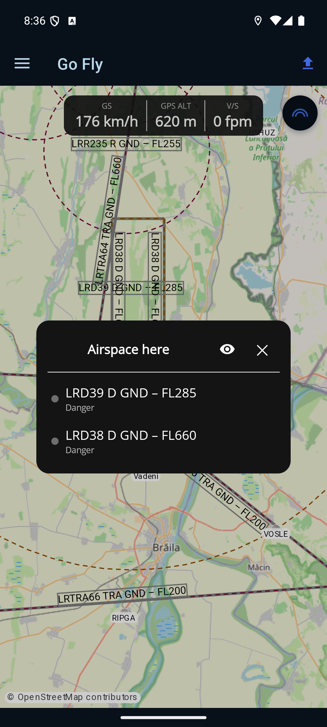
Long-press anywhere on the map to open an “Airspace here” card listing every area stacked under that point, lowest floor first, each with its category. Tap a row for the detail — vertical limits, the currently active range, and the full NOTAM where one applies. The eye (peek) button fades the card so you can see the highlighted area on the map; ‹ Back returns to the list and × closes it.
Location and battery
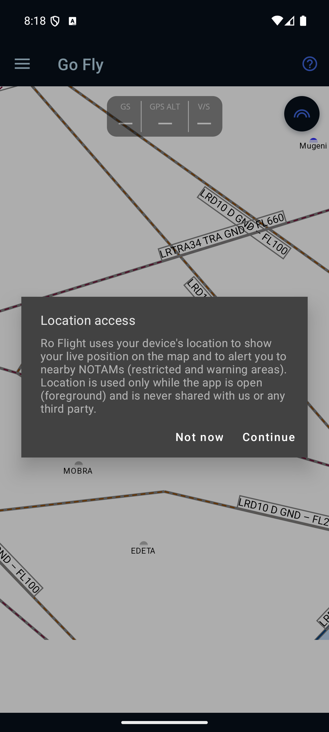
The first time you open Go Fly, Ro Flight explains why it needs your position before your phone asks for the permission:
Location access. Ro Flight uses your device's location to show your live position on the map and to alert you to nearby NOTAMs (restricted and warning areas). Location is used only while the app is open (foreground) and is never shared with us or any third party.
Choose Continue and then allow location while using the app. (Not now leaves the map working without a position.)
- The GPS only runs while this screen is open. Leaving Go Fly stops it — the app does not track you in the background.
- The screen is kept awake while Go Fly is open, so the map doesn't blank mid-leg. Expect the battery to drain faster than usual; a charger is a good idea on a long leg.
Small print on the map itself
- No scale bar. The top-centre spot a scale bar would take belongs to the instrument strip; the planning map keeps its scale bar.
- © OpenStreetMap contributors sits in the bottom-left corner and is tappable — it opens the OpenStreetMap copyright page. The base map is OSM, and the credit is a condition of using it.
- Map tiles you have already viewed stay available for 30 days, so a stretch with no signal doesn't blank the map. This is a cache, not an offline download — ground you have never looked at will still be blank.
← Back to the manual · See also: Getting Started walkthrough →